Copper vs iron mine drainage: telling the signatures apart from above
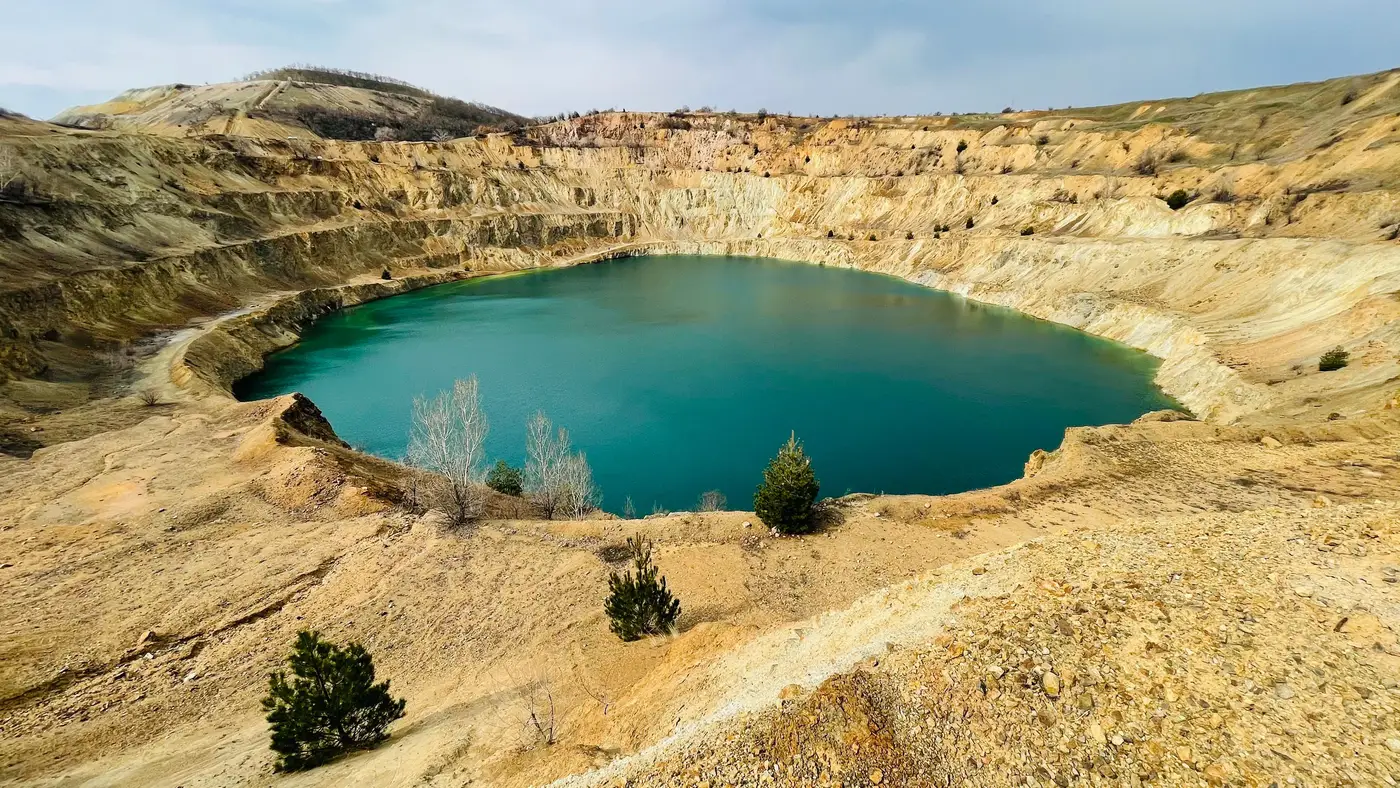
Two color families show up again and again when you're screening a watershed for acid mine drainage, and they mean different things. Get them backwards and you either chase a non-issue or miss a real one.
The ochre signature: iron doing what iron does
Pyrite and other iron sulfides oxidize when they hit air and water. The reaction produces dissolved ferrous iron, which then oxidizes further to ferric iron and precipitates out as a family of iron oxyhydroxides: ferrihydrite, goethite, jarosite. These coatings are why AMD-affected streambeds and settling ponds turn that unmistakable rust-orange to yellow-ochre color. It's the same chemistry that stains a bathtub faucet, just at watershed scale.
In multispectral imagery this reads as strong reflectance in the red and near-infrared, with a characteristic absorption feature tied to the iron oxide itself. A pond or reach coated in ferrihydrite looks warm, almost brick-colored in true color, and the contrast against the surrounding rock or vegetation is usually sharp enough to flag from a wide-swath pass. Iron is the dominant signature at most sulfide-bearing sites because pyrite is so common as a gangue mineral. If you're screening a legacy coal or polymetallic site, ochre is very often the first thing you see.
The turquoise signature: copper's different chemistry
Dissolved copper behaves differently in water than iron does. It typically occurs as cupric sulfate or copper carbonate complexes, stays in solution, and tints the water itself blue-green to turquoise. The color is the same family you'd recognize from a lab beaker of copper sulfate or from a weathered copper roof. In a tailings pond or an evaporation cell at a copper operation, a turquoise tint signals that metals are dissolved and actively moving through the system.
Spectrally, turquoise water shifts reflectance toward the blue-green bands and away from red, which is close to the opposite pattern from an ochre-stained pond. On a multispectral pass this is usually enough to separate the two signatures without needing hyperspectral resolution, though the wide-swath, 10 to 30 m imagery used for a monthly screen won't resolve fine mineralogical detail, only the broad color class.
Where the two show up together, and what confuses them
Most active sulfide-ore sites produce both signatures at once. A copper-bearing deposit still carries pyrite, so you'll often see ochre staining on the margins of a pond with a turquoise core where dissolved copper concentration is highest, or an ochre plume downstream of a pond that has already lost most of its copper to precipitation. Reading the two together gives the clearer picture: a pond that goes from turquoise to brown over a few monthly passes is precipitating copper out as it's buffered by downstream dilution, a different regulatory question than a pond that stays turquoise for a year straight.
A few things produce false positives for either signature. Glacial flour and fine clay suspension can mimic a turquoise cast in alpine watersheds with no mine influence at all. Algal blooms shift green rather than blue-green but can be mistaken for copper signatures at a glance. Pond liners, especially blue or teal synthetic liners used at some tailings facilities, will read turquoise regardless of water chemistry, which is a known trap if you're screening a basin you don't know well. None of these replace a water sample. What a monthly spectral screen gives you is a reason to send someone, or not, rather than a lab result.
The practical takeaway for a watershed screen
If you're flagging ponds and tracing plume extent across a watershed every month, the color alone won't tell you parts-per-billion concentrations. It will tell you where the chemistry is active and where it's been dormant, and whether a plume is growing, shrinking, or shifting color class over time, which is often the more actionable signal for prioritizing a site visit. Mine Water Quality builds exactly that flagged-pond and plume-extent layer from wide-swath imagery, on a monthly cadence, for regulators and ESG teams who need to know where to look before they commit a sampling crew.
If you've got a watershed you're trying to screen this way, we're running it as a pilot on defined basins now.