Field notes: the orphan mine with no owner, and the plume that returns every spring
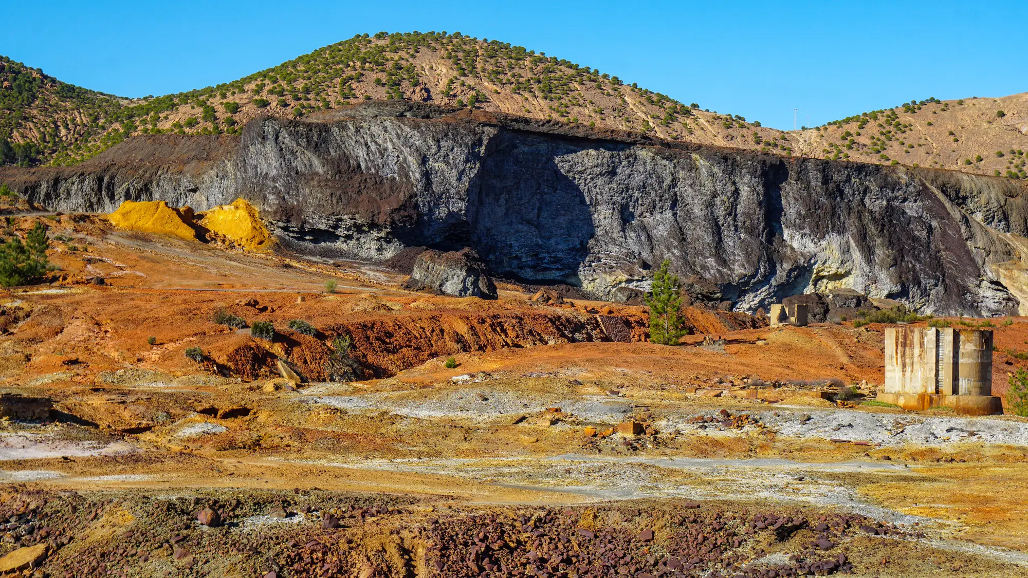
Every AML inventory has at least one entry like this: "owner unknown," "operator defunct," "responsible party not established." The adit is still there. The portal pool is still there, rimmed in that unmistakable ochre crust. And every spring, right on schedule, the plume shows up in the creek below it, like it's kept on a calendar nobody else is watching.
I've walked a few of these. The pattern is almost boring in how consistent it is. Snowmelt or the first heavy spring rains push through backfilled stopes and old workings that have been quietly flooding and oxidizing all winter. Pyrite in the rock meets water and air, sulfuric acid forms, and the metals that were locked up in the host rock start moving. By the time that water daylights at a seep or an adit mouth, it's carrying enough dissolved iron to paint every rock downstream the color of a rusted-out truck bed. Give it a few hundred meters and the iron hydroxide floc drops out, you get the classic ochre staining on the streambed, and if there's copper or zinc in the mix too, you'll sometimes catch that strange turquoise cast in the standing water of an old tailings pond nearby.
The paperwork is what sets orphan sites apart from permitted ones. A permitted, bonded operation has a responsible party on the hook for treatment and a monitoring schedule that catches this before it becomes a seasonal event. An orphan site has nobody. The company dissolved, merged, or walked away before bonding requirements existed at all, and the land has changed hands two or three times since, usually to someone with no idea what's draining off their back forty every April. State AML programs know these sites exist, often from a one-time reconnaissance survey or a complaint filed a decade ago, but there's rarely a standing monitoring line item for a site with no permit to attach it to.
So the plume becomes a known unknown. Everybody who's worked the watershed long enough can tell you it happens. Nobody has a current read on how far it's running this year, whether it's gotten worse since the last site visit, or whether last year's partial remediation upstream did anything at all. The data point that would answer that is a ground sampling trip, and sampling budgets go to sites with an open enforcement action long before they reach the quiet orphan that's causing nobody any immediate trouble.
That's the gap worth naming plainly: these sites don't lack a problem, they lack a trigger for attention. Nothing forces anyone to look until a fish kill or a complaint forces the issue, and by then the plume has been running for who knows how many spring seasons already.
It's part of why I've gotten interested in watershed-scale screening that doesn't depend on a site having an owner to send a sampling crew to in the first place. A monthly pass that just reads the color signature of a pond or a plume extent across the whole drainage treats the orphan site the same as the permitted one. The landscape doesn't care whose name is on a deed. If you want to see what that kind of screen flags across a defined watershed, the approach is laid out on the Mine Water Quality home page.
None of this replaces a sampling program where one exists or ought to exist. But for the orphan sites sitting in the gap between "known to AML staff" and "actively monitored," a repeatable look at the water color each spring is at least a way to stop relying on memory and old survey notes. If you're trying to get a current read on a watershed full of sites exactly like this, that's the problem Mine Water Quality is built to help with.