Turquoise vs. ochre: what each color tells you about mine drainage chemistry
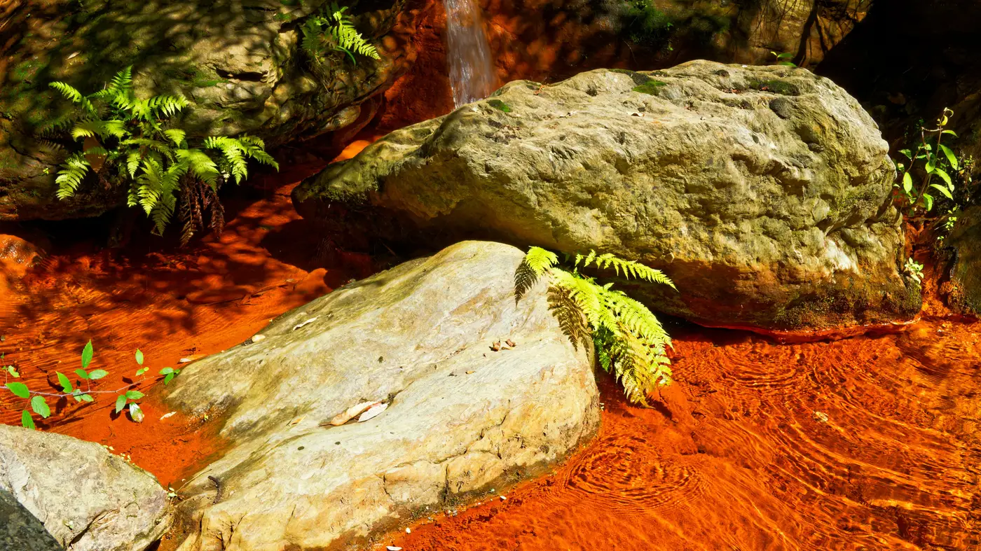
Walk a drainage channel below an old adit and you'll usually see one of two colors doing the talking: a rusty ochre coating the streambed, or a milky turquoise pooling behind a check dam. They're not interchangeable warning signs. They come from different metals precipitating under different conditions, and reading which one you're looking at tells you something about where that water sits on the pH curve before you ever pull a sample.
Ochre: iron coming out of solution
Ochre is iron. Specifically, it's iron oxyhydroxide, the family that includes ferrihydrite and goethite, forming as dissolved ferrous iron (Fe²⁺) oxidizes to ferric iron (Fe³⁺) and then hydrolyzes out of the water column. That reaction needs oxygen and it needs the pH to climb above roughly 3.5 to really take off, which is why you so often see it at a seep's outlet or downstream of a riffle where the water's had a chance to aerate rather than right at the portal.
The practical tell: if the water coming out of the ground looks clear but the channel a hundred meters downstream is stained orange-red, the iron was dissolved at the source and only dropped out once it hit air and a higher pH. That staining pattern means the source water held enough acidity to keep iron dissolved all the way to the surface, and the ochre downstream marks the exact point where it finally precipitated out.
Ochre sludge is also the easiest of the two to confirm on the ground. It cakes on rock, it's heavy, and it settles into channel beds and pond bottoms rather than staying suspended, so a grab sample from standing water sometimes under-represents how much iron is actually moving through the system.
Turquoise: usually aluminum, sometimes just clarity
Turquoise or milky blue-green water is most often aluminum hydroxide, Al(OH)₃, precipitating as colloidal particles too fine to settle quickly. Aluminum starts dropping out of solution around pH 4.5 to 5, a slightly higher threshold than iron, so a pond running turquoise rather than ochre can mean the water's buffered up a bit from raw acid rock drainage but hasn't neutralized all the way.
There's a second, less obvious cause worth knowing: some of the most strikingly turquoise ponds on a mine site aren't precipitating much of anything. They're extremely acidic, pH 2 to 3, with metals still fully dissolved and no suspended sediment to cloud the water. Without particulates scattering light the way a muddy or iron-stained pond does, the water reads clear to turquoise simply because there's nothing in it to turn it brown. That's the case that trips people up: a pond that looks the least alarming from the bank can be carrying the lowest pH and the highest dissolved metal load on the property. Color alone won't separate "well-buffered aluminum precipitate" from "raw acid, nothing precipitated yet." Both can look similar from a distance, and both warrant a closer look.
Reading the sequence, not just the snapshot
Follow how the color changes along a flow path rather than judging any single pond on its own. A seep that's clear, turns ochre within a few meters, and then turns turquoise further downstream is tracing a rising pH curve: iron drops out first, aluminum follows once the water's buffered further. A system that stays turquoise for its whole visible length without ever showing ochre either skipped the iron-rich stage entirely or the iron precipitated somewhere you can't see, upstream, underground, or in sediment nobody's walked to. Either way, that's a reach worth a field visit before it's a reach worth a lab report.
None of this replaces a water sample. What color gives you is a reason to go sample one spot over another, and a way to track whether a plume is growing or receding between site visits without putting a tech in the water every time. For a watershed with more legacy workings than staff to walk them, that's the screening step that's usually missing: a standing, monthly read on which ponds and reaches are showing these signatures right now, flagged before the ground crew is sent out. That's the layer Mine Water Quality builds from wide-swath imagery each month.
If you're staring at a watershed map with more flagged candidates than field days, it's worth seeing what a monthly ochre-and-turquoise screen would surface on your own ground.