What is a receiving water mixing zone, and why it matters for a mine discharge permit
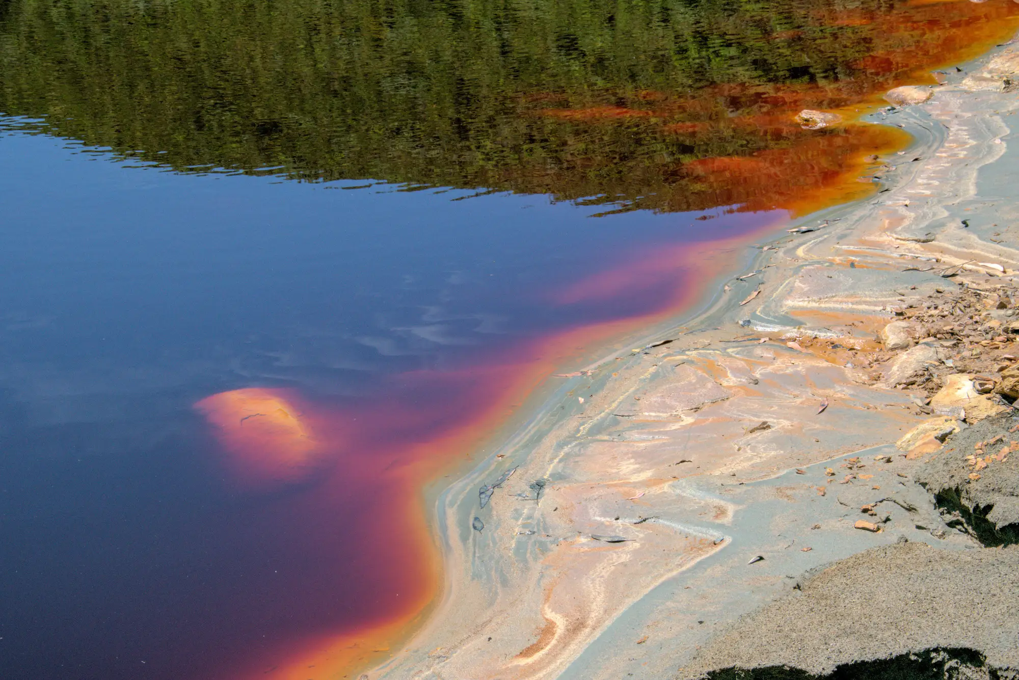
A receiving water mixing zone is the defined stretch of stream downstream of a discharge pipe where permit writers allow water quality to still be in transition, not yet meeting the ambient standard that governs the rest of the waterbody. Outside the zone, the water has to meet the full standard. Inside it, dilution is doing part of the work, and the permit tolerates that for a limited distance.
For a mine discharge, that distance is the reach of creek or river where acid rock drainage from a tailings pond, waste rock pile, or adit is still mixing with base flow. Metals load, pH, and sulfate concentrations inside the zone can exceed the chronic or acute criteria that would otherwise apply anywhere else in the stream. The permit sets a compliance point, usually a fixed distance or a specific coordinate, where the mixing zone ends and the water has to be back within standard.
Where the permit's numbers apply
This is the part that trips people up the first time they read an NPDES permit end to end. The effluent limit on the outfall itself is almost always stricter than what's allowed inside the mixing zone, and both are different from the ambient standard that governs the river past the compliance point. Three numbers, three locations, and a lot of room for someone to read the wrong one.
A permit writer sizes the mixing zone using stream flow data, usually a low-flow statistic like 7Q10, along with the discharge volume and the pollutants of concern. For AMD-influenced discharges that's typically dissolved iron, manganese, aluminum, sulfate, and pH. The zone has to stay small enough that it doesn't block fish passage or wipe out a spawning reach, and the agency reviewing the permit will usually cap its length or width explicitly in the document.
Why it matters for anyone reading the permit from outside
If you're screening a watershed for ESG purposes or checking a facility's compliance history, the mixing zone is where the easy assumptions fall apart. A site can be in full compliance at its official compliance point and still have a visibly stained reach of creek bed upstream of it, inside the zone, where the water hasn't finished mixing yet. That staining, the ochre precipitate that shows up when dissolved iron oxidizes and drops out of solution, is a real signature of acid mine drainage. It doesn't automatically mean a permit violation. It can just mean the mixing zone is doing exactly what it was permitted to do.
The reverse happens too. A mixing zone sized on paper for flow conditions from a decade-old reissuance doesn't necessarily reflect what's happening on the ground now, especially at legacy sites where the discharge volume or the upstream pond chemistry has drifted since the last permit cycle. A pond that's turned turquoise from secondary mineral precipitates, or a plume that now runs well past the old compliance point, is worth a second look regardless of what the permit file says.
None of that shows up from reading the permit alone. You need to see where the color stops relative to where the paperwork says it should stop, and making that comparison site by site with a ground crew is slow and expensive at watershed scale.
Where imagery fits
This is the gap a monthly watershed screen is built for: catching ochre and turquoise plume extent against the compliance points already on file, across every active and legacy site in a watershed at once, instead of one enforcement visit on one stream reach at a time. Mine Water Quality runs that screen from wide-swath multispectral imagery on a monthly cadence, flagging ponds and downstream plumes so you know where a mixing zone is visibly running past its paper boundary before you plan a sampling trip.
If a watershed's mixing zones haven't been checked against what's flowing downstream lately, start with a pilot screen on the area you're responsible for.